Aerial Drone Mapping
RTK Accuracy, within Centimeters
Precision Drone Mapping for Informed Decision-Making
Welcome to Flying High Productions, your trusted provider of accurate Orthomosaic/Photogrammetry aerial mapping. With our cutting-edge technology and expertise, we offer high-precision aerial RTK drones that seamlessly integrate centimeter-level navigation and positioning with a state-of-the-art imaging system. By enhancing map efficiency and accuracy, we reduce operational difficulties and costs, making us the ideal choice for your mapping needs.
Capture properties with unparalleled precision, detail, and accuracy. Our orthomosaic/photogrammetry aerial maps provide reliable data for calculating area, volume, and distance, empowering you with the insights you can trust. Whether you require construction site visualization and analysis or comprehensive data for site planning and modeling, our drones deliver exceptional results.
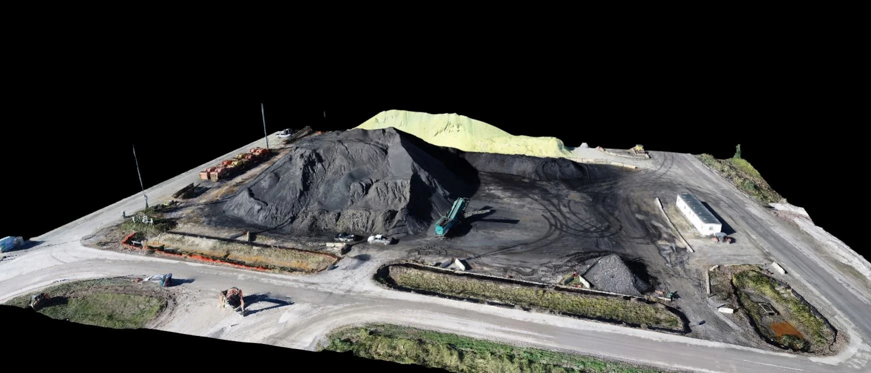
Our specialized mapping techniques play a crucial role in determining precise volume estimates. Leveraging state-of-the-art technology, our maps serve as invaluable tools for detailed and accurate volumetric assessments, empowering informed decision-making in your projects.
Construction Projects Redefined
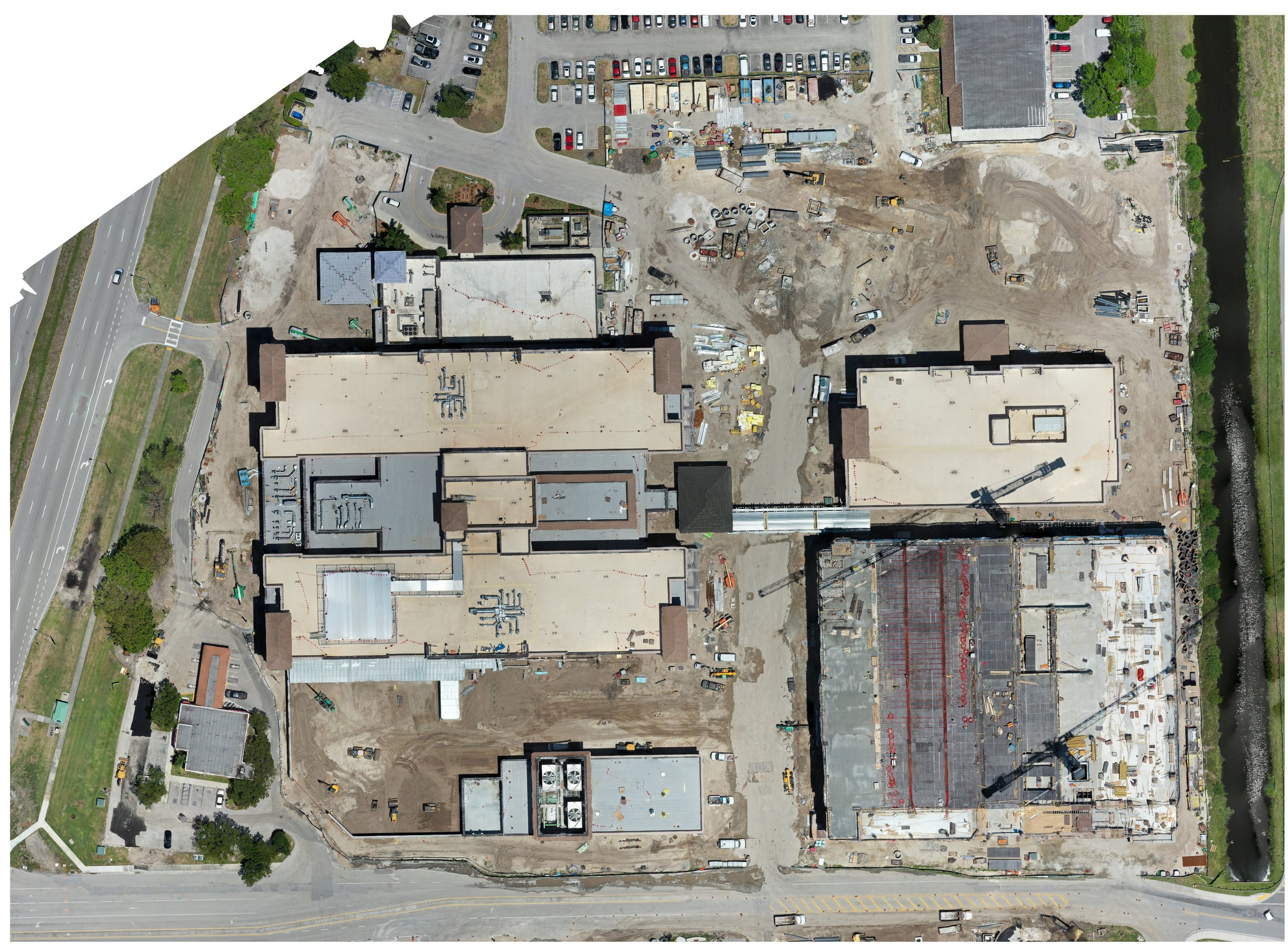
Immerse yourself in the world of interactive 3D models for construction sites and commercial properties. Flying High Productions collects comprehensive data that fuels your site planning and modeling efforts. With our monthly updates, you can easily track progress, gather valuable data, and showcase your completed work.
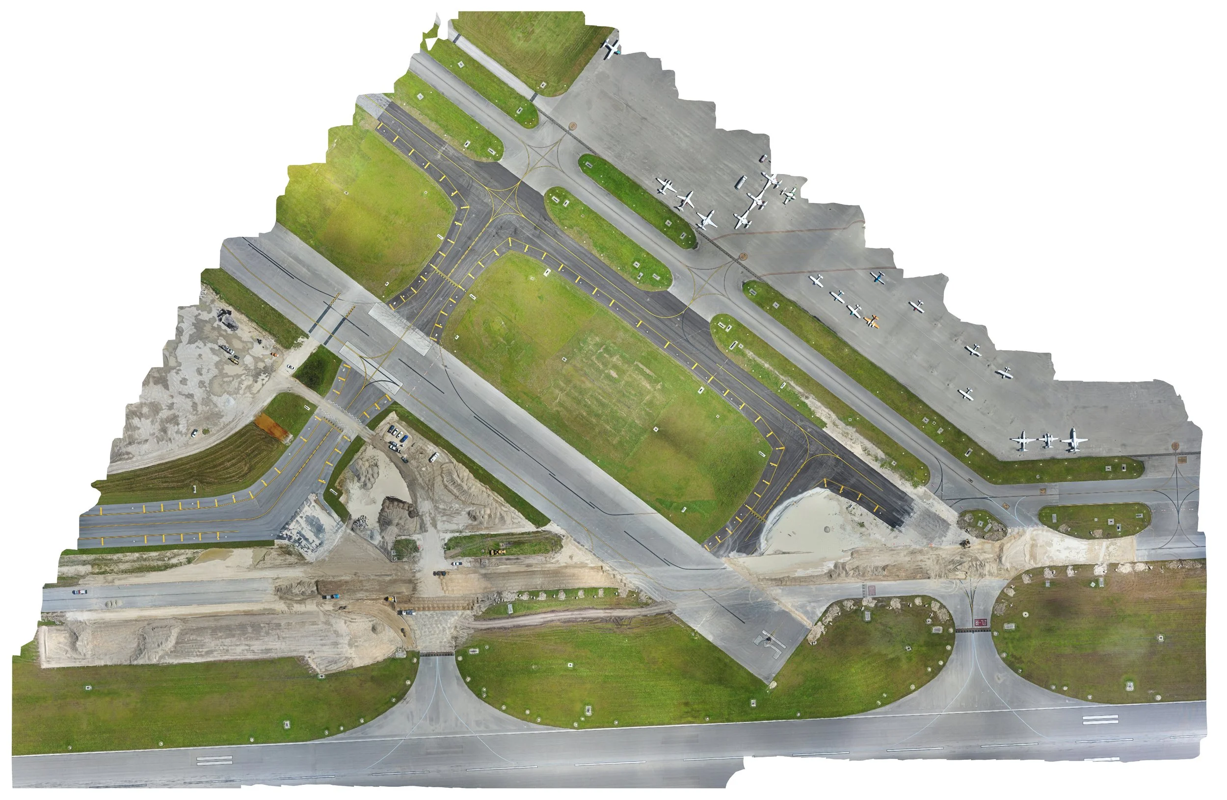
Aerial Mapping of a Construction Site. You can follow progress, see elevation changes, take measurements of volume and area and so much more with RTK results. Even at TMB Miami Executive Airport 22-23.
Our specialized software allows for comprehensive evaluation of site conditions, including precise measurements of stockpiles, volumes, and elevation changes. Backed by our RTK technology, our results are reliable and dependable. We are your trusted support team, complementing the efforts of licensed Contractors, Surveyors, and Engineers.
Contact us today!
Call or Text: 786-443-6648
Email: info@flyinghighproductions.org
Empower Your Industry
Drone mapping is revolutionizing various industries, and we cater to the diverse needs of professionals like you. Contractors, roofing experts, insurance adjusters, and solar installers can leverage our services to conduct quick and accurate inspections, measurements, and real-time progress tracking. Designing roofs and solar panel farms has never been easier, as our intelligent tools provide visual context and expand your team's capabilities.
Experience the power of visual intelligence that supports your critical decisions. Schedule recurring flights with us to consistently capture progress over time, enabling you to stay up to date and make informed choices.
Efficiently managing a 3.2-acre rooftop through advanced roof mapping techniques.
This detailed roof map serves as a comprehensive guide, facilitating precise work instructions (WI) for seamless roof access. Elevate your team's proficiency with our visual aids, designed not only for operational excellence but also as invaluable tools for staff training.
Contact us Today!
Call or Text: 786-443-6648
Email: info@flyinghighproductions.org
Industries we serve:
Roofing Companies
General Contractors
Insurance Companies
Building Management Companies
Facility Management Firms
Solar Panel Manufacturers and Installers
Make the smarter choice today. Contact Flying High Productions and equip your team with the tools they need for success.
Contact us today!
Call or Text: 786-443-6648 Email: info@flyinghighproductions.org
Precision in every dimension: Harnessing the capabilities of our RTK-enabled drones, we leverage cutting-edge technology for accurate volume measurements. Elevate your project with our advanced solutions, providing reliable estimates that redefine precision in aerial assessments.
Layout Precision Validation: Rely on our meticulous approach to ensure the accuracy and integrity of your layouts. Our verification process utilizes advanced techniques, guaranteeing that every detail aligns seamlessly with your plans. Trust us for precision in layout validation, an essential step towards flawless project execution.
Strategic Mapping for Accurate Volume Estimation
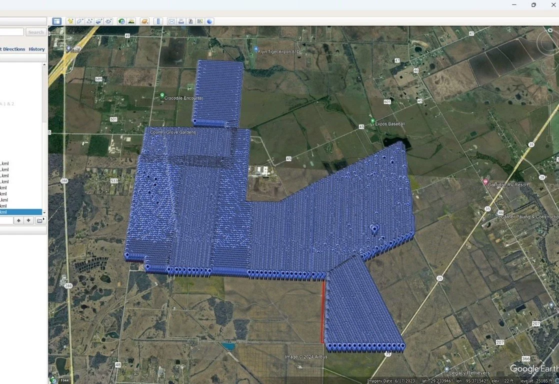
502 MW Solar Farm
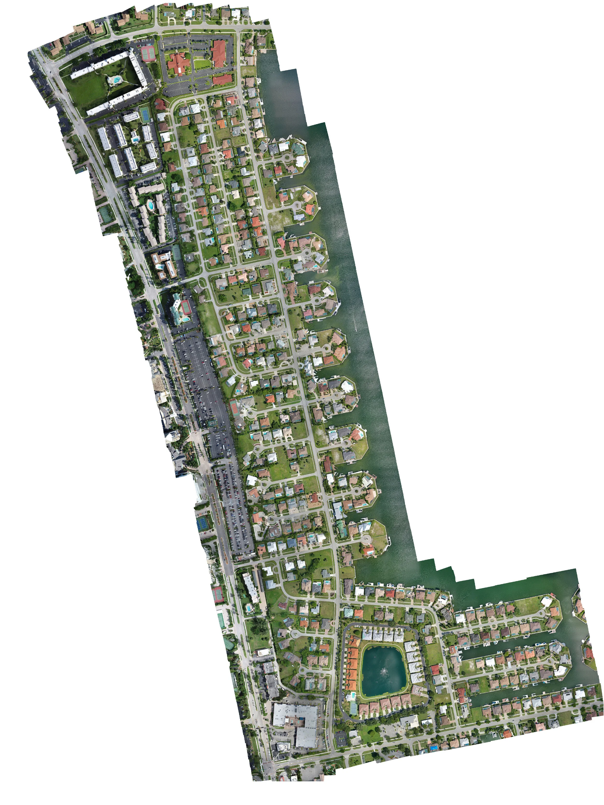
Marco Island Road Condition Map 247 Acres
